Showing posts with label ice. Show all posts

Tuesday, March 3, 2015

Tuesday Evening Winter Storm Update

Updated: 0030z/19:30/07:31PM
*****Emergency Alert for the Period NOW until Tomorrow Morning*****
Guys Obviously this front thump of snow has overachieved in everyway. Currently recording almost 5" at my house, and a friend in White Plains has the same recording. White Plains Airport is at 4.9" officially as of 7pm.
Please, please be careful - now we are changing over to an Ice/Freezing Rain/Sleet Mix and it will stay like this for the next SEVERAL hours before changing to plain rain around or after midnight.
Anymore Accumulations should be between 1-3" of this mess, maybe a bit more.
FORECAST
TONIGHT - ICE/freezing rain/sleet/snow continuing before changing over around midnight to rain. Additional Accumulations 1-3" if not more. Temps around freezing.
TOMORROW - Rain and dense fog, rain may be heavy at times in the morning, but doubtfull. The GROUND will be below freezing so WATCH out for Ice!!!!! GONNA be a really MESSY morning.
A lull in the precipitation as cold front comes through and storm pulls away, our second wave forming.
TOMORROW NIGHT - Rain turning to ice to all snow by midnight and continuing, temps in the mid to high 20's.
THURSDAY - Snow in the morning through afternoon tapering off in the evening. Could be significant accumulations. Temps in the high 20's.
FRIDAY - Frigid watch for rapid freezup highs in the low 20's.

FORECAST DISCUSSION
A rapidly deepening low pressure system will continue to move across Southern Canada and take over with rain after midnight tonight. As it pulls out tomorrow a wave will form off the bucket loads of moisture along the frontal boundary (cold/warm air) Where this frontal boundary will determine the exact trend of the heaviest snows, but it seems that the Arctic Air coming behind it will be enough to suppress the axis of heaviest precipitation along NYC to Philly. We would once again be on the northern edge of the heavy (ish) snows. Right now I am calling for 3-5" with a possibility of going down and up. Dillon thinks 1-2". What should be noted is that as the storm intensifies, much like today, the snow ratios will bump up especially from the air rapidly cooling. We can expect 12:1 ratios and maybe 15:1 if lucky. Also keep in mind that the heaviest snows are NYC to Philly - NYC is less then 30 miles away. It would really not take MUCH for us to get in the heavier snows again. An example is that Yonkers has a Winter Storm Warning for 4-8" of snow, and here in Irvington we have no warning and just 2-4" of snow. Not far to move!. however as of now this is the forecast. You could say Dillon scored a "coup" I still have my doubts though!
This second half of the storm should continue into Thursday afternoon and evening. Initial first call snow map is below.
Guys, even if we do not get 8-12" with the next batch of snow - it will be very icey, very dangerous tomorrow into Thursday afternoon. This is NOT a storm to take lightly, especially because of its long duration.
Ok thats it for now! Be back later if need be
 
smile emoticon

Monday, March 2, 2015

Monday Evening Upcoming Storm(s) Weather Update

Updated: 0100z/20:00/08:00PM
FORECAST
TONIGHT - Pretty much clear, lows in the low teens to single digits maybe in far northern and northwest areas of NY and New England.
TUESDAY - Clear skies will give way to thickening clouds, temperatures in the high 20's to right around 32°, Snow and sleet developing in the LATE afternoon (SEE SNOW MAP), 1-3" (could change, but we doubt it) into the evening and nighttime.
TUESDAY NIGHT - Snow/sleet changing over to ice/sleet/rain and finally all rain by Wednesday morning, nighttime temps around freezing...WATCH out this could be a SERIOUS ice situation as ground is frozen, and a lot OF cold air around...
WEDNESDAY - Ice/wintry mix changing over to all rain in the morning (around rush hour probably maybe a bit sooner/later) will continue throughout the morning, may be a bit heavy at times... Should be a lull in the precipitation during the afternoon as the Initial [storm] moves out then starting again in the evening. Temps in the high 30's to low 40's.
THURSDAY - We have a BIG potential to waking up with NEW snow on the ground and snow falling, as a new wave forms off the back of the Lake Cutter and comes through Wednesday Night through Thursday afternoon/evening...We WILL have cold air in place and this could be a BIG storm...we will keep you posted.
FRIDAY - COLLD Rapid freez up Thursday night, Highs in the low to mid 20's, mostly sunny.
FORECAST DISCUSSION
We have a VERY wild week ahead! A bit of a break today and most of tomorrow before our next storm arrives. A lake cutter will form and move across the area. Since the Center of the Low pressure will be FAR to the N and W of us, it will be a mostly rain event - HOWEVER, we have plenty of cold air in place so watch out for a big THUMP of snow Tuesday evening into the night 1-3" locally 2-4" before a changeover to rain/sleet/ice into Wednesday morning then all rain Wednesday. NOW the interesting part - a brief lull in the precipitation HOWEVER, bucket loads of moisture with this system, and the models have been insistant on another wave forming along the Arctic Frontal Boundary. Cold front will come through Wednesday night, new shot of colder air, and a new wave will form to the SW of us and move ALONG that frontal boundary towards us. THIS would be our all snow event, or Rain to ALL snow event starting Wednesday night and lasting through Thursday Afternoon likely. At this point accumulations could be anywhere from 5 to 10" although that could change. WHEREVER this front boundary sets up is where the axis of heaviest snows will be. If I take an average from ALL the 6 models with snowfall maps, that gives NYC metro area and northern Suburbs 6-8" snow. A wet heavy snow too.
So keep an eye out for our posts - wild week ahead. More cold for Friday as well with a flash freeze Thursday night.
***THE SNOW MAP IS ONLY FOR TUESDAY NIGHT THROUGH WEDNESDAY MORNING***

HAVE A GREAT NIGHT!

Sunday, March 1, 2015

********MIDDAY UPDATE - SNOW IS COMING*******

Snow is showing up on radar but not hitting the ground yet - most likely due to the dry air. In any case light snow will begin in the next couple of hours, and will really kick up this evening into the nighttime.
We are bumping back the end time, it will be all over by the very early hours of Monday morning, most likely before rush hour.
Nothing else is changing in our forecast.


_________________________
HAVE A GREAT DAY!

Saturday, February 28, 2015

*****SATURDAY 10pm UPDATE - WILD WEEK AHEAD GUYS, REALLY WILD*****

FIRST, Quick moving quick hitting THUMP of snow late tomorrow afternoon through Monday late morning. A small but somewhat potent system will move through the Ohio valley tonight into tomorrow and then across the area tomorrow evening throughout the night before moving out late Monday morning. NOW, alotta the weather sites saying 1-3" or 2-4" total...GUYS Sorry BUT NOT GONNA BE THAT WAY! Rain snow as well...Nope its gonna be all snow, MAYBE a bit of ice on the backside..
SECONDLY...Mesoscale Banding - VERY important in this storm, maybe more so then in other storms. The models are showing a large amount of southerly winds (flowing to the north) on the warm side of the Arctic air boundary...the models are showing this continue as the storm moves over us. WHERE the edge of this warm wind and cold air meet BOOM thats where we will really get that thumping. NOW the models cannot accuraterly depict this, so they are saying 4-6" (.4-.6" QPF), but wherever those bands set up could easily bring that up 4-8" or 6-10"...NOW, that could be high, Dillon and I think a safe thing to assume is 4-8" for almost all north of NYC...read map to see details

___________________
___________________
NEXT STORM...OMG so much to talk about this, but will wait until Monday to give all the details...Timing likely Tuesday night through Wednesday night maybe into Thursday morning but that could change. It would be Snow to ice to rain to ice to snow to all snow and could be a lotta snow if this holds up - models trending colder by the day! Goodbye brief warmup!
___________________
___________________
SOO.. still slowly creeping back to normal ISH temperatures in the next couple weeks, but the models are holding fast for below average temps at least next 40 days...soo we will keep you updated!
__________________
__________________
TONIGHT - Cold lows in low teens to around 10°, clear, but getting cloudy.
SUNDAY - Cloudy with light snow developing between 3-6pm changing to a heavier more steady snow during the late evening through the nighttime. Highs in the mid to high 20's. WATCH out for that thumping, talked about above in the afternoon.
SUNDAY NIGHT - Snow, HEAVY at times with THUMPING possible, maybe changing to ice/sleet for a brief period at the end. The storm will be outta hear by lunchtime the LATEST in NYC, most likely between 7-9am.
MONDAY - Snow ending between 7-9am, highs in the low 30's
TUESDAY - Cloudy highs in the high 20's to low 30's...storm approaching at night, more on this later.
__________
HAVE A GREAT NIGHT

Wednesday, February 25, 2015

********WEDNESDAY EVENING 8:30PM UPDATE**********

Sorry about no update last night, Dillon and me were both very busy, and we did not feel there was enough to make a meaningful post. Its been a quiet week!
*****************
Feels warm past couple of days right! SLOWLY, ever so slowly we are trending (barely noticeable) back to "average" temperatures...Now the question is will we get back to Average or ABOVE average? At least in the next 2 weeks - We doubt it. Maybe a few small warm ups here and there for a couple hours...but overall models trending Below to WELL below average for the next several days, into the 2-3 week margin...maybe even through the next 45 days?
*****************
Many storms on the horizon, first big one would be Sunday to maybe Tuesday, likely Sunday night - Monday night. Right now Rain/ice to snow maybe back to rain or all snow...many details to workout too early too say much.
Tomorrow morning chance of light snow and some snow showers as a system passes to the south. Little to no accumulation for us.
*****************
TONIGHT - Lows near 10° progressively colder North and NW of NYC. Clear but becoming cloudy as the night goes on.
THURSDAY - Possible Light snow/snow showers (Most likely some flurries - BUT) No accumulations likely. Highs in the low to mid 20's.
FRIDAY - Highs in the mid 20's, some sun some clouds.
SATURDAY - Sunny highs near 30°, overall a pleasant day smile emoticon
HAVE A GREAT NIGHT GUYS!

Monday, February 9, 2015

**********8PM Update Monday**********

Total snow for today was 2.9" - on the LOW side of our 2-5" Forecast, but still within that. Boston on the other hand, and areas around there - THEY are the winners. Approaching 6-7'+ of snow on the ground up there!!
*********************************
Rest of the night should start to clear out a bit, any light snow/sleet/ice will end by midnight. Temperatures will go down in the Highs teens/low 20's.
TOMORROW - Clouds will continue to clear out, Highs around freezing, WATCH for ice that may have formed overnight.
WEDNESDAY - Mostly Sunny, Highs in the High 20's to very low 30's.
THURSDAY - Next possible storm? Could evolve into a biggie, but for now 2-4" ish of snow late Thursday through Friday morning. Watch this carefully though because we could be in for a big storm.
Next storm after that would be for the weekend, and also could be a BIG one.
INTENSE, BRUTAL and coldest air of the season coming starting Thursday into the weekend. Highs could possibly barely reach the 20's, with lows well below 0°. We shall know specifics later, but seriously cold air coming.
********************************
Have a great night guys!!!

Sunday, February 8, 2015

**********8:00PM UPDATE SUNDAY************

Guys, this is an extremely tricky storm to forecast - so bear with us. We are sorry for the lack of updates this weekend, we were both out of town and without computers - hard to do updates without them! ANYWAY, we are back so lets get to the weather!
****************************
This storm is NOT a big snowmaker for us, rather a much BIGGER Icemaker...We are ON that line as usual though, of the cold and more snow...So, 20-30 mile changes - EVEN LESS then that, COULD MEAN BIG changes for us.
***************************
TIMING - Freezing rain/sleet will break out tonight if not before midnight by midnight, continue through the morning and change over to snow late morning/midday. Light Snow will continue through the afternoon, probably not too heavy. Icing will continue as well mixing a bit with snow through the evening. It will change back to all snow and continue through Monday night ending between 1-4am or a bit before...generally very very early hours of Tuesday.
***************************
ACCUMULATIONS 

***************************
BIGGEST HAZARD - ICE ICE ICE....THERE IS A MUCH MUCH GREATER CHANCE OF ICE WITH THIS SYSTEM THEN LAST, BECAUSE TEMPERATURES WILL NOT BE QUITE AS COLD. GROUND TEMPS HOWEVER WILL BE WELL BELOW FREEZING - WE ALL KNOW WHAT HAPPENS THEN - IT FREEZES ON CONTACT.
With Snow NOT changing over until LATER in the DAY MONDAY, and temperatures not going BELOW freezing until AFTER MIDDAY, ICING WILL BE A VERY BAD PROBLEM for the Morning commute, and EVEN the Afternoon/EVENING commute which will be EVEN MORE dangerous as it changes back to a wet, sleety, icy snow.
****************************
Temperatures tomorrow will be JUST around or UNDER 32°, even into Upper 20's if we are lucky. North of I84, you will be mostly snow, even north of I287. Temperatures will begin to drop after lunchtime and continue dropping to low to mid 20's by nightfall - ANY Wet/melted ground will freeze up..on top of any ice that formed.


AGAIN, THIS IS NOT A BIG SNOWMAKER FOR US...MUCH MORE OF AN ICE MAKER - WHICH IS MUCH WORSE.

Monday, February 2, 2015

**********10:45 AM UPDATE ON WINTER STORM LINUS [#LINUS]*********

VERY VERY HAPPY WITH THE FORECAST THAT DILLON AND ME PUT OUT LAST NIGHT, VERY HAPPY. 7.58" SO FAR, NO RAIN YET JUST SLEET AND ICE AND SNOW. 

The storm ended up coming in a tad weaker and was not able to push that Arctic HP as much away, therefore cold air lasted longer.

SO WHATS NEXT?

We have a Secondary low trying to/succesfully ish forming off the Delmarva Peninsula (Well really between Jersey Coast and Delmarva) and THIS will drain some more cold air south and fuel a redevelopment of precipitation as the two fronts collide LATER THIS AFTERNOON.

SO...SLEET, ICE, SNOW will CONTINUE for the next few hours AND THEN a POTENTIAL HEAVY BAND OF SNOW WILL DEVELOP AFTER LUNCH AS THE BACKSIDE OF ALL THIS MOISTURE WRAPS AROUND and the Secondary low moves NE. 

REST OF TODAY - Snow/Sleet/Ice continuing and then turning back to an all snow solution after lunch for a TIME. SNOW COULD BE HEAVY. Additional accumulations of 1-4" ARE POSSIBLE as that heavy band comes through, WE WILL UPDATE ACCORDINGLY.
Temperatures in the High 20's in NYC to Low 20's in Westchester and PROGRESSIVELY colder as you get N/NW/NE of NYC. IMMEDIATE COASTAL AREAS - MORE OF A RAIN/SLEET MIXTURE.

FLASH FREEZE IN EFFECT FOR THIS EVENING, TEMPERATURES DROPPING 20-30° FOR SOME TO LOW TO MID TEENS OR UPPER SINGLE DIGITS. ALL STANDING WATER, MELTED PRECIP, UNTREATED ROADS, ETC WILL FREEZE

All precipitation will taper off this evening into nighttime and gradually clear by midnight.

PLACES SOUTH OF YONKERS, COASTAL CT, LONG ISLAND...YOU WILL HAVE A POTENTIAL COMPLETE MESS OF ICE ON YOUR HANDS AS TEMPERATURES RAPIDLY DROP AND MOISTURE MOVES IN, PRECIP KEEPS FALLING. BE CAREFUL

Additional Snow accumulation map below.

ANY QUESTIONS? IF SO POST IT BELOW IN THE COMMENTS OR MESSAGE ME OR DILLON.


Sunday, February 1, 2015

********11PM UPDATE ON WINTER STORM [LINUS?]*********

Snow Has started moving into the area, the ACTUAL system still WAY back in Western PA. The storm looks to be tracking a TAD south of what was thought - GOOD for snow lovers. Models continued to trend south a tad as well, only like 5-10 miles...but any trend is a good trend south.

IT WILL STILL be a close call with rain/snow line - WE ARE EXPECTING A POTENTIALLY SERIOUS ICE SITUATION FOLKS! Looks like at this point we cannot get out of that! UP TO A HALF AN INCH of Ice COULD ACCUMULATE ON TOP OF 5-8" OF SNOW! BE CAREFUL FOLKS!

So, Looking like a GOOD 6-9 hours of SNOW before we start thinking about changing over to wintry mix.

PERSONAL OPINION FROM DILLON AND I - BAD IDEA FOR SCHOOLS ON TWO HOUR DELAY, GOING TO BE VERY VERY ICY AND BAD ROADS/CONDITIONS TOMORROW. LETS HOPE THEY CHANGE THEIR DECISION.

BACK TOMORROW MORNING WITH UPDATES.

STILL HANGING ONTO SNOW ACCUMULATION MAP FROM BEFORE.

************************************************************************


http://radar.weather.gov/Conus/northeast.php


*********************QUICK Sunday Afternoon Update!**************

The GFS and the NAM have continued their northward trend since yesterday, meaning that there is the chance of less snow and more mixed precipitation especially during the height of the storm on Monday. However, this means SIGNIFICANT ICING is becoming increasingly likely, which is much worse than an extra few inches of snow. For now, though, Remy and I will keep our forecast from last night and will re-post the snow/ice map we made yesterday as the European and Canadian models from midnight are sticking with significant snowfall for the area. Based on some of the data right now, the GFS and the NAM may be too warm with the storm, and they might head towards a solution closer to the European and Canadian models later in the day. Our current snowfall map is more of an average between the four models. We will follow this storm throughout the day and post again later on this afternoon around 5:00 PM when the next model runs come in.

Here is yesterday's snow map, which (for now) still applies:


Sunday, January 18, 2015

************EXTREMELY IMPORTANT UPDATE FOLKS, PLEASE READ*************


EXACTLY WHAT I SAID YESTERDAY WOULD HAPPEN, IS HAPPENING. EVEN THOUGH WE HAVE RAIN FALLING, THE GROUND IS COLD ENOUGH THAT IT IS FREEZING ON CONTACT.

I JUST SPENT THE LAST HOUR GETTING MY MOMS CAR UP OUR DRIVEWAY BECAUSE OF THE 1/8" THICK LAYER OF ICE THAT IS ON IT.

THE ROADS ARE SLIPPERY, DILLON REPORTS TO ME THAT THE TACONIC IS CLOSED.

DO NOT TRAVEL, JUST DONT. NOT WORTH IT.

FLOOD ADVISORY WILL LIKELY GO UP LATER, BUT IF NOT...JUST KNOW WE HAVE SOME HEAVY HEAVY RAIN HEADING OUR WAY AND IT WILL NOT BE SOAKED UP ON FROZEN GROUND - IT WILL FLOOD.

TRUST DILLON AND I ON THIS. PLEASE.

Latest radar ----> http://radar.weather.gov/Conus/northeast.php

Sunday, January 11, 2015

**************SUNDAY EVENING UPDATE ON OUR STORM FOR TOMORROW************

*****PUTTING OUT AN ALERT FOR A PERIOD OF FREEZING RAIN, ICE PELLETS AND SNOW/SLEET FOR TOMORROW MORNING THROUGH AFTERNOON******


*****ROADS WILL BECOME SLIPPERY, ICEY, NOT GOING TO BE A GOOD COMMUTE TOMORROW*******

********CALLING FOR MORE A WINTRY STORM FOR THE SUBURBS THEN MANY THINK...IMPORTANT**************

OK FOLKS, once again, as it seems with all of these storms this year, another hard forecast as the boundaries of precip types, amounts, etc. are EXTREMELY close yet again.

A weak low pressure system/overrunning system will continue to form in the Ohio valley tonight and move eastward with a swath of rain to the south and ice/sleet to all snow to the north. THIS IS NOT like the last storm where it took a northerly track over the lakes and was able to bring in all that warm air that brought the highs in to the 50's. This is also where we run into trouble with this storm. It is NOT bringing in much warm air if any at all, and therefore is dealing with whatever arctic air is left in the atmosphere as it moves through.

As usual, the forecast that Dillon and I made for this storm is more RISKY then the major weather sites and other people. But, this is what we feel will happen, and what my gut is saying. I will explain it all below.

***************************************

OVER THE PAST WEEK almost, our area has experienced record cold temperatures as all of you have known. In addition to this we have had a 2" layer of snow on the ground for a good portion of that time of extreme cold. SNOW refrigerates the air, and keeps it cooler, so for the past 4-5 days the snow on the ground has been refrigerating the air. Consequently, the forecast temps for our area have been MUCH warmer then the actual temps have gotten too. We have been averaging around 4° or more below the forecast temps, and this will factor into tomorrow's forecast.

As the system comes through the area, it will have ALOT of moisture to deal with, and the convection looks to be strong, especially up in the upper levels of the system where the air is perfect for snow.


SO, TO CONCLUDE, WHEN I SEE THE MAJOR SITES SAYING AN ICEY RAIN/SNOW MIX TO AN ALL RAIN EVENT..., AND THEN I LOOK AT THE RAW DATA - I SEE 2 COMPLETELY DIFFERENT SCENARIOS.....AND PERSONALLY, I TRUST THE RAW DATA (Which Dillon and I still have to interpret) ALOT BETTER!


Here is the forecast:

TONIGHT - Light snow/sleet will break out in the wee hours of the morning, temps steady in the High 20's/VERY LOW 30's. I would say the earliest time precip will be beginning is 6-7am. 

MONDAY - Light snow/sleet will transition rather quickly to a freezing rain. GUYS, the TEMPS aloft ARE REALLY COLD! AND THE TEMPS ON THE GROUND ARE ALSO REALLY COLD! IT IS THE TEMPS FROM THE SURFACE TO ABOUT 500-1000 FEET THAT ARE WARM ENOUGH FOR THE LIQUID TO MELT, AND THEN FREEZE ON CONTACT!!!! DANGOROUS STUFF! Freezing rain/ice pellets will transition to a period of rain in the middle of the day, but not for long and then BACK to a SNOW/RAIN MIX....GUYS, I AM BETTING ON MORE OF A SNOW then RAIN MIX here. Temps will RISE to the low to mid 30's by afternoon. Suburbs north of NYC...I DOUBT we will get above 34°. To the North and WEST expect HIGHS in the high 20's to very low 30's.

Map is attached to show the different precip types, accumulations.
TOTAL DAYTIME ACCUMULATIONS:
SNOW - .5-1", MAYBE 1-2" IF WE ARE LUCKY
ICE - 0.10"-.25" - GUYS THIS IS BAD, ICE BAD!!!

Storm will move out in the evening/night hours and COLD air will follow.

*********************SNOW DAY PREDICTION/OPINION FOR THOSE WHO CARE************

Personally, given the type of precipitation, and the timing of the ice (morning) and then the change to snow/rain - I DO THINK there SHOULD be a snowday. BUT THIS IS NOT! AGAIN NOT! MY DECISION! Just my opinion!

********************Dillon will UPDATE THIS TOMORROW BETWEEN 5-6AM********************************************************************

MONDAY NIGHT - STORM CLEARING OUT, TEMPS GOING DOWN TO LOW TO MID 20'S

TUESDAY - SUNNY, highs in the low to mid 20's

WEDNESDAY - Partly sunny chance of a few flurries in the morning, highs near 30°

MAPS BELOW.

*********UPDATE COMING AROUND 5-6AM TOMORROW*********

Thursday, January 8, 2015

********THURSDAY EVENING UPDATE, BIGGIE*********


OKI DOKI FOLKS...WE GOT A COUPLE NICE DAYS OF WEATHER...THEN WE HAVE A GOOD CHANCE AT IT ALL KINDA GOES DOWNHILL FOR NEXT WEEK  WINTER STYLE...SO GET READY!

- Looking at essentially 3 events over the next week:

One tonight into early tomorrow morning, THIS is our clipper, maybe 1-2" of fluff in the wee hours before it moves out, essentially acting as if it is a frontal wedge coming through the area...do not be surprised if we get some blurbs of 1-3" or more!

Second one Sunday night through Monday night - Dont know SPECIFICS yet, but lets say for now a mix of snow/ice/maybe rain and just icky!

THIRD one for Wednesday Night through Friday Morning, this one will likely be the biggest of the week, looking at again snow/sleet/ice/maybe some rain.

I am just putting it out there, DO NOT take this as a forecast, but I would NOT be surprised if by the end of next week we have a good 4-8" of snow on the ground if not more...AS OF NOW! AGAIN THIS CAN ALL CHANGE!

- COLD will start to ease off a bit for the weekend and into next week into low to mid 30's, but then it is looking likely that we will drop back down into 20's or colder after that!

- WINTER HAS ARRIVED, THIS IS ALL I CAN SAY!

CURRENT conditions at IHS Weather Station:

Temp: 16.5*F
Humidity: 64% and rising
Pressure: 30.27"
Winds: WSW @ 3 mph
DewPoint: 7*

Today we reached a high of 20.3 at 3pm, a low of 4.2* at 4am.

*******FORECAST******

TONIGHT - Temps dropping down to near 10*, clear becoming cloudy, some snow showers/light snow breaking out in the very early hours, max 1-2" of fluff.


FRIDAY - Snow showers/light snow in early morning taper off to snow showers, should clear up a bit partly cloudy by afternoon. Areas to the North and West will be a bit colder and have some longer bouts of snow...Temps rising to mid 20's...again colder North of NYC.

SATURDAY - Temps in mid to high 20's, clear, nothing really to worry about!

SUNDAY - Partly cloudy temps around 30* maybe low 30's, getting cloudier...storm possibly arriving nighttime - MORE later on this!

WILL GET INTO NEXT WEEK OVER WEEKEND!

Saturday, January 3, 2015

********EVENING UPDATE******


I am happy to say that the snow amounts that I forecasted came out more or less right on target! I knew that there was too muhc cold air here that it would be all rain today  silly weather sites  

SO,.. Here is the deal! Forecast for the rest of the night and tomorrow:

TONIGHT - Snow/Sleet will turn to Sleet and then ALL rain by 9pm for pretty much everybody south of Albany. Peoples North of Albany and Concord, NH expect it to stay an icey/sleety/snowy mix until late tonight before changing over to all rain. Temps will rise to mid to HIGH 30's.

TOMORROW - WOW MUCH WARMER! I dont think nearly as warm as some are saying (61*!) BUT we will definately get up into 50's, and possibly break that 60* mark, but probably only for folks SOUTH of I287/Thruway.

MONDAY - First cold front moves through Sunday night finish up its passage Monday, temps in the mid 30's, partly cloudy.

GETTING INTO TUESDAY We have an Alberta Clipper that will MOST LIKELY affect us Tuesday afternoon into evening. Since Alberta Clippers are fast and hard to predict until they are basically on our doorstep, we will get into this Monday night!

Latest Radar image below!


****MIDDAY UPDATE FOR THE STORM****

Snow Still falling at a good clip here in Irvington, expect it to stay as a Snow/Sleet mix for the next several hours for ALL areas NORTH of I95/I84 before changing over to an Icey rain to all rain by nightfall. Unless you are FAR north, WELL north of Albany, do not expect it to stay as snow past dinner time.

TOTAL daytime accumulations 1-2" and MAYBE 1-3" in the hills, Elevation dependent. 

Warm air starting to surge in as you can see on the image I have posted below..expect temps to go up into the mid to high 30's as it changes over to rain. Tomorrow HIGHS in the low to mid 50's. Rain. MORE ON THIS TONIGHT.

Have a great day!


Friday, January 2, 2015

Friday Night discussion and Forecast for Weekend storm, SNOW Forecast map

BOY DO WE HAVE AN INTERESTING STORM COMING!

OK, Here is the deal...I am looking at 4 different models right now and ALL of them are telling me one thing, while the websites you might be going on like weather.com might be telling you the complete opposite of what I am about to forecast for tomorrow. I am NOT saying these sites are wrong, but what I am seeing on the models and how I am interpreting it is telling me we are in for a whole different story then what they say! I will explain this below. 

Step #1 - Storm has already formed in the South/mid area of our country over Texas and will continue to move NE over the Great Lakes and join up with a small system that is dropping down from Farther North. As it moves through those lakes it will intensify, and have the opportunity to start bringing in warmer air. 

Step #2 - COLD AIR! YESS! TONS OF IT AHEAD OF THE SYSTEM, AND TONS BEHIND! The PROBLEM is the Area of High pressure that we need to just sit put and let that cold air stay will be moved and decimated by the system, which WILL allow it to bring in the warmer air at the surface during the NIGHT on Saturday into Sunday night. The Southern Jet will help with this too. SO, Start as some Snow/Icey/Slushy mix as the cold and dry air that is already around will be cold enough for snow, and then as the colder air is replaces by warmer moist air in the evening of tomorrow it will turn over to rain for the night and into Sunday, and move out Sunday night...Sound like a plan??!


SO HERE IS MY FORECAST:

TONIGHT - COLD in the mid 20's, clear becoming quite cloudy.

TOMORROW - Cloudy in the morning, SNOW most likely starting lunch time to 2pm IT COULD COME IN HEAVY and be quite nasty until the evening!!! Highs low to mid 30's, colder to the North and West. Areas North of Hudson, Windham/Kingston area...It WILL be not FUN to be OUT up there!!!

TOMORROW NIGHT - Changeover to Sleet mid evening hours and all over to rain by 9pm for ALMOST ALL even up into Northern NY and Southern New England. Nighttime temps will rise to MID to HIGH 30'S as the system brings in all the warm air and continues its trek.

SUNDAY - Highs rising into low to mid 50's for almost all up even past Albany then into 40's north of there. Rain and maybe some Thunder in the morning will begin to clear out of the Hudson valley area in the afternoon, nighttime for areas east of NY.

MONDAY - COLDDDD FRONTS MOVE IN and Probably bring some of the coldest, if not the coldest air of this season with it! Monday wont be AS cold Highs in the low to mid 30's

TUESDAY - Highs in the mid 20's...Probably a clipper in the afternoon evening, usually clippers bring 2-4, 3-5" of snow...so we shall see!


Thanks again to Weatherbell and Dr. Maue for the AMAZING MAPS AND GRAPHICS!

Tuesday, December 30, 2014

********TUESDAY NIGHT FORECAST/DISCUSSION, UPDATES ON WINTER STORM FOR WEEKEND...BIGGIE!***************

-POTENTIAL FOR A [BIG?] WINTER(Y) Type storm coming onto the short term models for this weekend, Saturday Night through Sunday night...maybe just maybe into Monday morning. DETAILS BELOW
- Tug Hill area off of Lake Ontario, Watertown area - LAKE EFFECT SNOW WATCHES/WARNINGS IN EFFECT UNTIL FRIDAY MORNING. I would Not be surprised if you guys see anywhere from 1-2 feet or MORE in the persistent bands. So ENJOY IT, IF YOU ARE A SNOW LOVER...I WISH I WAS THERE I KNOW THAT!

- The Euro models AND the GFS are hinting at a MAJOR COLD SHOT in the 6-10 day period from now, I am talking 25+ degrees below average, possibly having a 0* day in NYC...I AM NOT SAYING THIS WILL HAPPEN, HOWEVER, IT IS SOMETHING TO KEEP AN EYE OUT THAT A BIG COLD SHOT MAY BE COMING...
**********WINTER STORM DETAILS for the Scenario I deem likely AT THIS POINT*******
STEP #1 Energy from the storm that will be affecting the Midwest and parts of the West Coast on New Years will move across the country while another area of low pressure that will bring some snow to the Northern Plains and North West drops down to the great lakes. THESE TWO SYSTEMS MERGE, and form what we weather weenies call "Lake Cutters" Basically the system will cut across the lake, and gather moisture, intensifying greatly...

STEP #2 The storm will LIKELY take this more NORTHERLY track (Although I think it will be further south, MORE COLD) and Consequently, as it moves through the area, it will suck in warm air from the south. SO AGAIN, ALONG THOSE COASTAL REGIONS...WATCH OUT IT WILL MOST LIKELY BE A MORE WET THAN SNOWY STORM, MORE ICEY TOO....HOWEVER:
1. As the storm makes its way through the area, it will bring in the warmer air from the south, however for a brief period of time..SO, even if it does get up to LOW 40's during middle of day, the storm will still be around later AND there will be PLENTY of cold air aloft for it to deal with - therefore, I think we are in for a more snowy event then we think....BUT...lets stick to more rain for now.


STEP #3...The system will move out of the area by Sunday night, leaving us MUCH colder as it brings in the cold air behind it. 

GUYS, I AM VERY WORRIED ABOUT THIS SYSTEM...The models are treating it as basically a "FRONTAL" system moving through the area, like a cold front...BUT IT IS NOT THAT! FURTHERMORE, the models are trying to "tear" the system apart as it moves through Western New York because of the INTENSE High pressure to the north of the system...I DO NOT THINK THIS WILL HAPPEN, AND THINK THE SYSTEM WILL TAKE A SLIGHTLY MORE SOUTHERN TRACK and CONSEQUENTLY be a colder storm for everybody.

One thing of IMPORTANCE, and of great interest...The NAO, which many people look to when they want to know when cold may be coming is NOT TO BE TRUSTED RIGHT NOW.... Last couple of weeks we had unusually HIGH temperatures and the NAO went NEGATIVE (Usually goes POSITIVE for Warmer Temps)...NOW we are getting colder and the NAO is going POSITIVE!...So, wacky things going on! Lets wait until mid February before we look at it as an Indicator of Warm/cold. 

OK ENOUGH BLABBER RIGHT NOW!

*********************FORECAST****************************

TONIGHT - COLLDDDD in the low 20's to High teens in the Northern Suburbs and interior NY...Along the coast a tad warmer. Clear, maybe some passing clouds.

WEDNESDAY/NEW YEARS EVE - Highs JUST about Freezing, again colder to the North and interior NY, warmer along the coast, sunny...a slight wind.

THURSDAY - Around the same temps, windy

FRIDAY - A TAD warmer, in the mid 30's, Sunny still windy.

PICS EXPLAINING THE WHOLE THING!

HAVE A NICE NIGHT FOLKS! And a HAPPY NEW YEARS!

Wednesday, December 10, 2014

QUICK Morning Update on some SNOW today!

Latest data shows A BETTER chance for a 1-3" accumulation of snow for today/tonight into tomorrow for the 2ND HALF of the Nor'Easter.

Rain and Snow will develop with morning and change to ALL snow in the afternoon, probably a LIGHT 1-3" IF WE are Lucky, although the data says we are, there is still uncertainty with this....SO JUST A HEADS UP!

Have A GREAT DAY!


Tuesday, December 9, 2014

Tuesday Evening Update and Discussion on Storm

TUESDAY EVENING UPDATE/DISCUSSION


NOW, ONTO THE STORM - In terms of the models, THERE WERE ALOT of problems with this storm, and its complexity and size...the MAIN issue was the warm air. None of the models saw it coming (Except the NAM) and what "it" was, was the fact that the storm was able to bring that warm air ALL the way north past Albany, West to Ithaca, and North to Portland, ME...This created a much bigger rain/ice event then expected, AND cut down those snow totals for many areas. Storm ALSO shifted EAST, causing the heaviest precip to move more OVER US, instead of Interior NY, NJ, and west of us.


SO, Otherwise, however, the system behaved as expected - NOW, WE STILL HAVE 2/3 MORE DAYS OF IT....ON AND OFF.
Now, I am happy that I can say I pointed this out a week ago when the storm initially came onto the models, and Dillon and I were in agreement with this, even as the system came through today - The REAL cold air (High Pressure System) would come on the STORMS heels, and behind it - not interact with it enough to cause a real SNOW event down here.

NOW, this IS HAPPENING! the Center of low pressure will use its self to form another low and swing back around in basically a circle over NY and New England - SO, NEW PRECIP FORMS, we get that moisture from the system interacting with that COLD air coming south, and PRESTO! BOO YA! Rain and Snow arrives tomorrow after a break in the precip today. I DO NOT EXPECT MAJOR ACCUMULATIONS, MAX 1-3" IN HIGH ELEVATION AREAS, BUT DO NOT BE SURPRISED IF THERE IS SNOW ON THE GROUND!


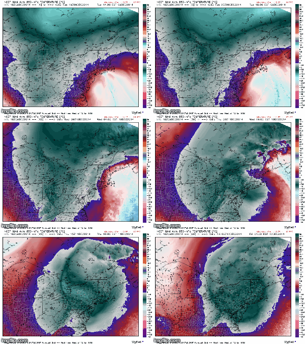
NAM 18z 850hPa showing temps invading (Blue/grey is COLDEST)


SO, FORECAST

TONIGHT - A LULL IN PRECIP, CLOUDY SKIES w/ some showers AS THE ORIGINAL LOWS SPINS UP INTO NEW ENGLAND. Some Rain/Snow/Sleet may still stick around in the Taconic Hills, Catskills, Putnam County up there South of Albany. Lows in the mid 30's...Winds 10-20mph

WEDNESDAY - Rain and Snow showers throughout the day, low to mid 30's. Winds back up there 20-30mph FOLKS up north of OSSINING WILL HAVE A MUCH BETTER CHANCE AT THE SNOW ACCUMULATING 1-3" OR MORE.

FLOOD WARNING STILL UP AS RAIN MAY GET HEAVY TOMORROW!

WEDNESDAY NIGHT - CLOUDY, SOME RAIN/SNOW LINGERING CLEARING OUT LATE. Lows near 30*....

THURSDAY - Some lingering snowshowers in the morning possible, then cloudy as the storm moves out Highs in the mid 30's

FRIDAY - Partly sunny, storm will begin to move out finally Highs in the mid 30's.


HAVE A NICE NIGHT FOLKS!!!

NAM MSLP+PRECIP, showing reforming of the Low.

Heavy rain moving North! - Morning Update

*********HEAVY RAIN, SOME ICEY RAIN MOVING NORTH, SNOW ON THE HORIZON*******

As the storm spins north it will tighten and intensify, and then stall over us the afternoon/evening. Expect heavy rain to continue, and some icey rain as well. Do not be surprised if some wet flakes fall as well! 

Getting more confident on a spread of snow wednesday night into thursday morning as the system loops around and the center of pressure reforms. MORE ON THIS LATER!

Folks to the North, in Putnam, up the taconic and into the catskills, DO NOT BE SURPRISED IF IT IS SNOWING, and POSSIBLY accumulating - this is a very elevation dependent storm!

Have a great day folks!